Everything is quite remote about the peaks dotting the western skyline of the Squamish river valley. The remoteness combined with the densely forested valley floor and glaciated topography higher up, lends it a special charm and a big mountain feel despite their relatively low elevation.
Ossa mountain stands tall at the northern end of the magnificent Tantalus range, and owing to its proximity to Ashlu creek FSR, is easily accessible (along with Pelion mountain) unlike other peaks in this range. However, the ease of access doesn’t rob the mountain of its remote feel.
I had planned to hike – I should say scramble – Ossa in a day. Although quite a strenuous undertaking, I think most individuals with above average fitness can complete it on the long summer days out here in BC. However, that did mean I had to start very early, especially since I had planned to catch up with two other climbers – Neha and Brittany – at camp higher up on the mountain.
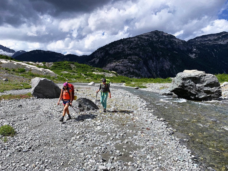
Early start it was. I reached the parking lot at 3.45 am. The dust particles swirled and collided in Brownian motion as I pulled my car on the side of the Ashlu creek FSR. Perfectness in randomness, I thought as I tried to procrastinate tackling the concerns I had with my plans. It was still quite dark and the serenity of the ambience was disrupted by the harsh beams of the headlights, and the grinding noise of rubber tires on gravel.
It was still quite dark out there – and almost an hour and half before dawn – but the moon was bright enough from where I saw it – 97% waning Gibbous – 25th July 2021. Not bad, I thought. However, I was well aware that the dense forest canopy covering the trail would be impervious to the mellow moonlight. There was no chance that I would have the visibility beyond the throw of the beams of my cheap headlamps.
This was riding on the back of the fact that I had not done very many solo hikes in a bear-territory and at night (almost). I could picture myself bumping into a bear as I would turn a corner on the trail. Near the trailhead, a prominent advisory sign warning the hikers about black and grizzly bear activity in the area added more color to my vivid imagination. Although, I very well knew the probability of such encounters is very less, the availability bias that comes along with being in a such a context did not help.
I pictured Neha and Brittany cozy and comfy in their sleeping bags. The plan was for me to catch up with them near the trio of the lakes camp enroute Ossa, around 7.30 am. It was already 4 am, and I had a good 10 km and 1300+ m of elevation gain to cover before I could reach them. Those stats looked like it commanded a good 4 hours of hiking and even if I started right away then I was going to have a hard time to make it on time. There was simply no way for me to wait till the day break – which was not to happen until 5.30am.
Trail head to Sigurd peak junction
It took me 20 minutes of allaying my concerns – which I failed at – before stepping out of my car gingerly at 4.15 am, switching on my headlamp and gradually warming up to the mile munching ahead. ‘I just try to fill my mind with good thoughts’, something Brittany told me later in the day. Exactly what I tried to do as I was taking it one step at a time looking ahead as far as the dim beam of light from my headlamp allowed.
Next challenge for me was to make good time on the trail. I wished I had done it as a two-day hike and camped higher up on the mountain as well. However, on the steeper sections, I was happy for not having had to lug around a heavy backpack if I were to camp overnight. Even with a lighter pack though, catching up with them at the decided rendezvous time was a stiff task.
After 1 hour of hiking in, at around 5.15 am I reached Sigurd peak junction – 2.7 kms and +600 m of elevation. Good time, but nothing spectacular. However, given the fact that I was fighting my inner bear-fear on a dark rugged trail without worrying too much about the time, I was quite happy with the speed so far.
Now, the moonlight gave way to the arriving sunlight, which slowly started penetrating through the forested canopy and onto my trail. It was time to speed up.
Sigurd peak junction to moraine camp
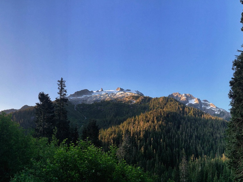
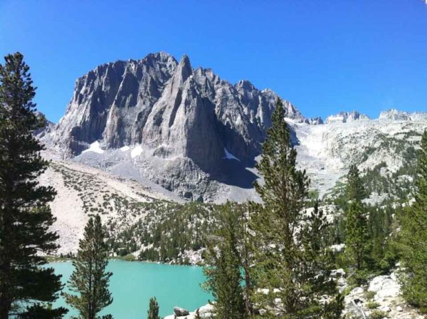
The next 4.2 kms are over gradually rolling terrain mostly – couple of steeper sections may be – but generally gradual, which I mostly ran taking care not to twist an ankle over the wet rocks and roots that are to be found aplenty on this trail. I was at Sigurd creek crossing in 2 hours, 6.15 am – approximately 7 kms in and 1000 m high from where I started. This section of the hike crosses a few brooks along the way and is mostly through thick canopy as well. When the forest opened up and allowed a glimpse of the skyline, I slowed down my pace to take a quick look at the western aspects of Pelion, which was now glowing in the gentle morning Sun. It was a refreshing sight.
Crossing Sigurd creek was a quick affair, gentle ankle level flow, albeit quite freezing and feet numbing. I was 90 minutes way as per my estimates from the trio of the lake camp, so without wasting much time, I dried my feet, drank some water, refilled my bottle and set out again. It was 6.20 am as I started up the steepening terrain towards the moraine camp. After a few minutes, as my numb feet regained its senses, I quickened my pace uphill. Nothing spectacular about this stretch, and pretty much the same story – steep grind up a thickly forested gradient.
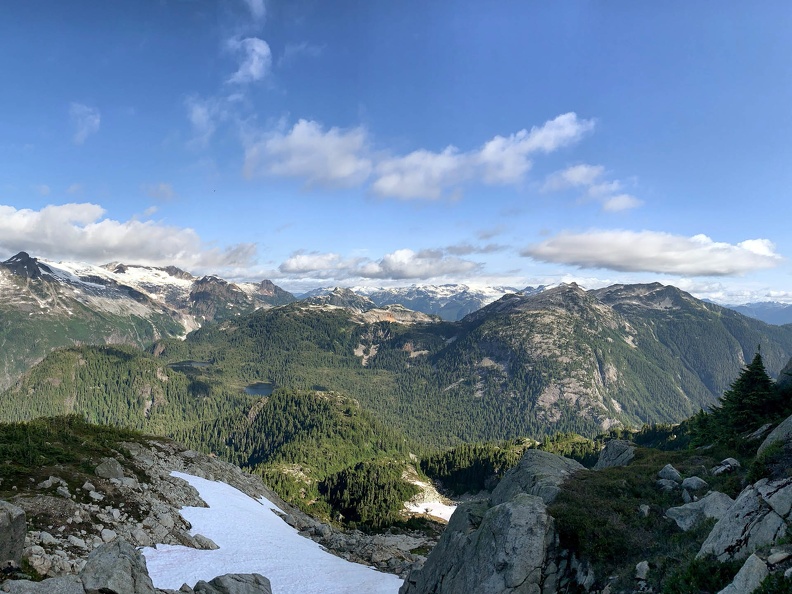
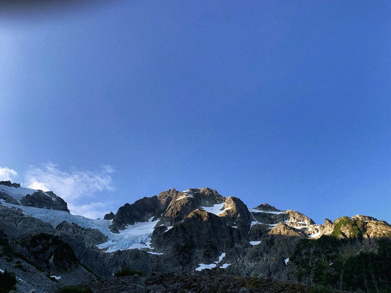
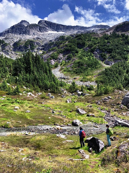
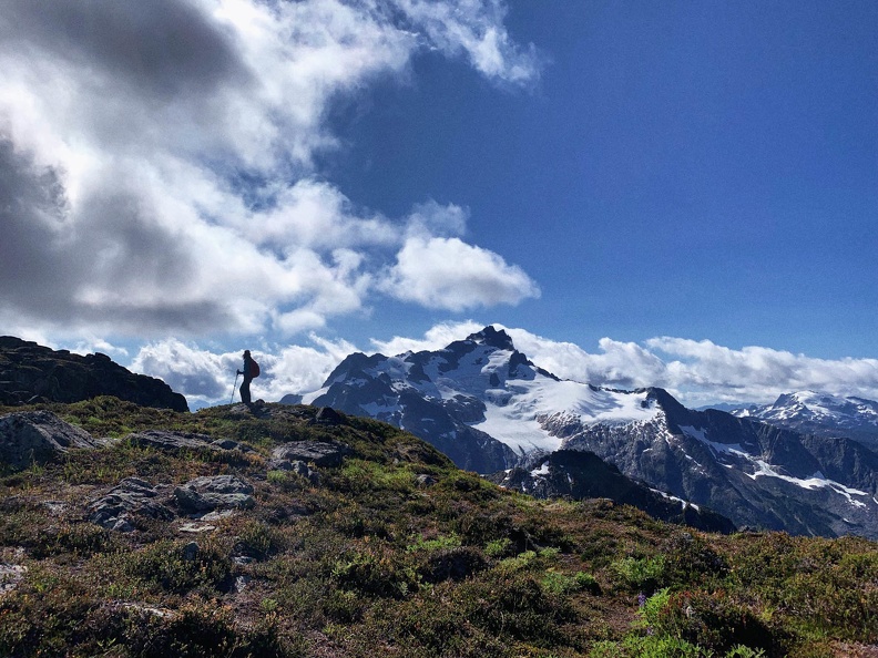
However, as soon as the forest gives away to a large boulderfield, the scene opens up and welcomes you with spectacular views of Ossa’s northern aspect and a very broken glacier flowing down from the Ossa-Pelion col. Mountains, I sighed!
By 7.00 am I was at the moraine camp. There were a few tents, I could count four pitched by the meandering glacial flow feeding into the Sigurd creek below. It is a beautiful campsite and I wished I could have camped here. Just another 30 minutes to the trio of the lake camp I thought. As I began to cross the moraine field, to my pleasant surprise, I stumbled upon Neha, wrapping up her breakfast right there at the moraine camp. 7.05 am my watch reach and I was super happy to make it on time and catching up with them without having them to wait for me. Total time, 2 hours, 40 minutes to the moraine camp.
I later learn that Neha and Brittany decided to camp at moraine camp itself and not proceed to the trio of the lae camp as per their original plan. Good decision I must say as the we later learnt that the trio of lake camp can’t hold a candle to the beauty of the moraine camp.
Brittany was still asleep and was quite surprised to see me up there at 7.00 am. She was pretty sure I would not make it before 8.00 am at the moraine camp. It took anther 40 minutes to wrap get ready and start again. It was a good break for me to replenish my energy reserves and recover for the long day ahead. I got a bit cold here waiting for 40 minutes though.
Moraine camp to summit & back
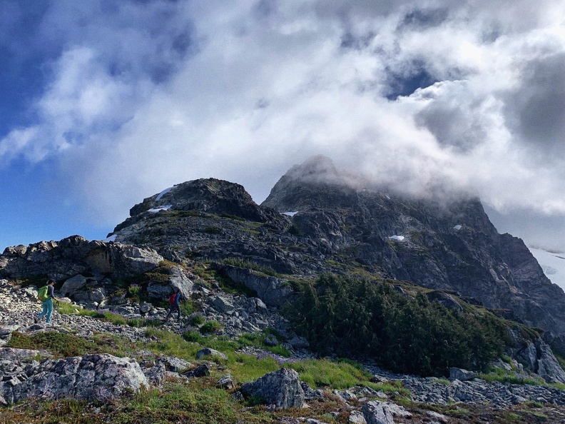
At 7.40 am we started towards the trio of the lake camp. It started to warm up and was a bit buggy near the lakes. There were dark clouds rolling in from over Ossa and Pelion and it looks a bit concerning. We pushed on and within an hour gained the west ridge of Ossa. Along the way there are a couple of snow ramps that we had to plod over – soft at this time of the year that we could easily kick in steps even with hiking shoes.
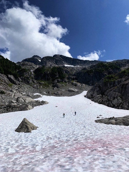
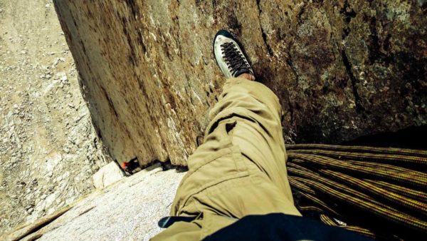
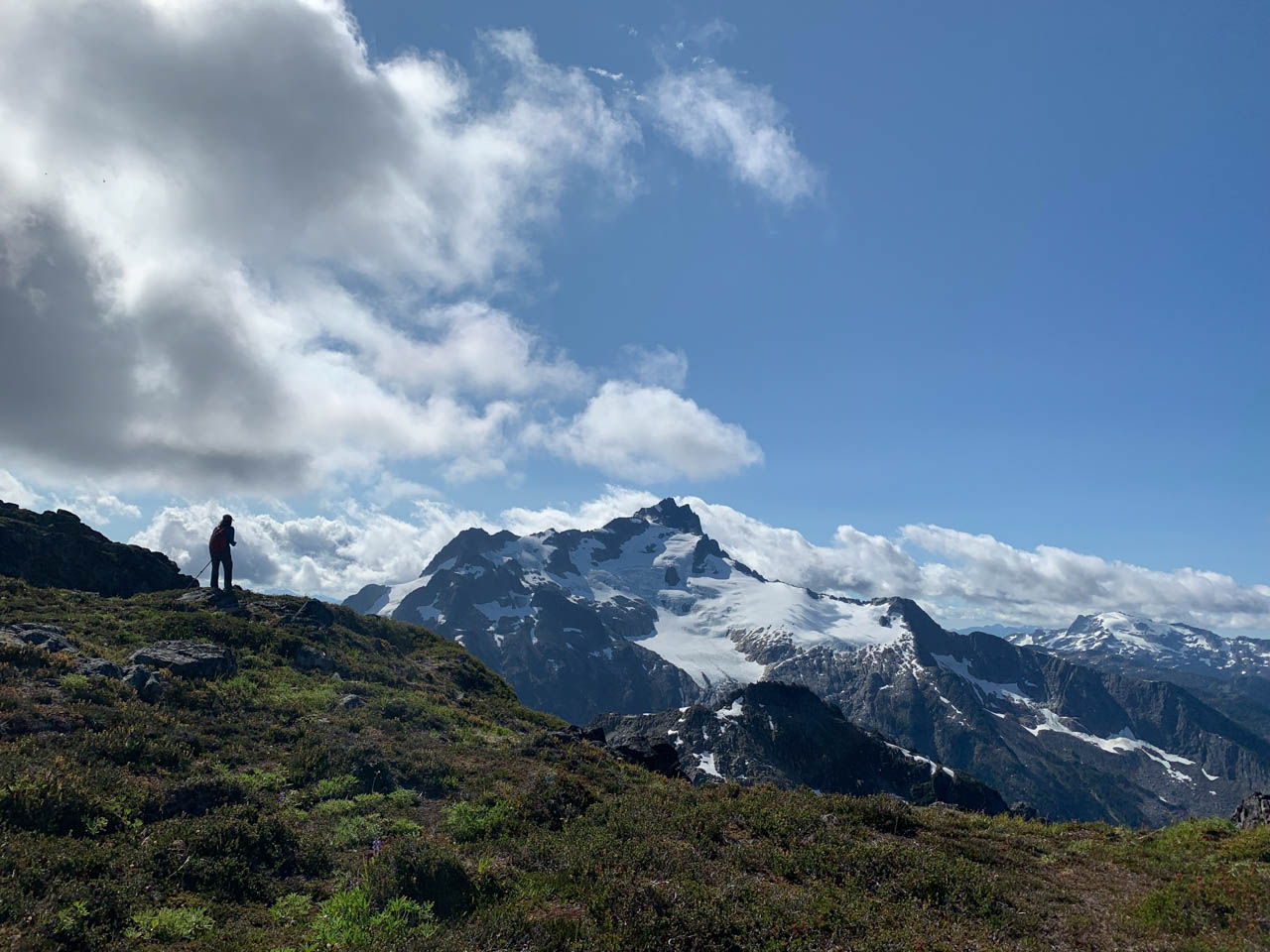
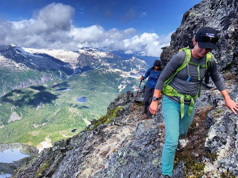
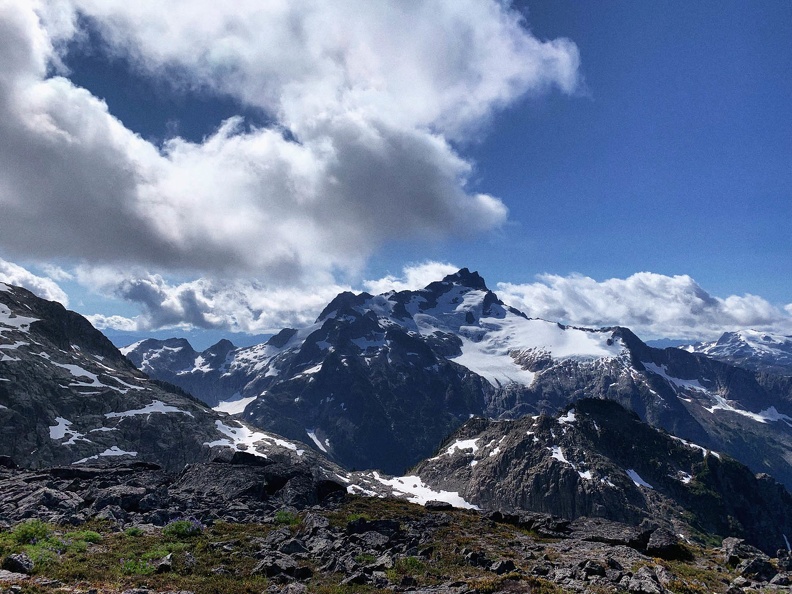
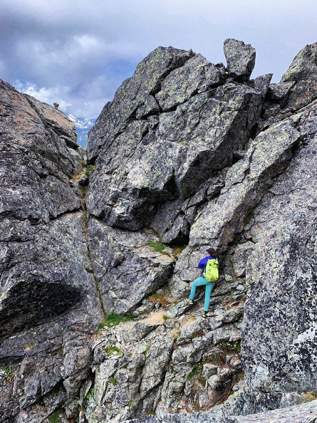
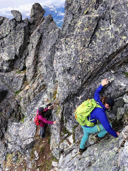
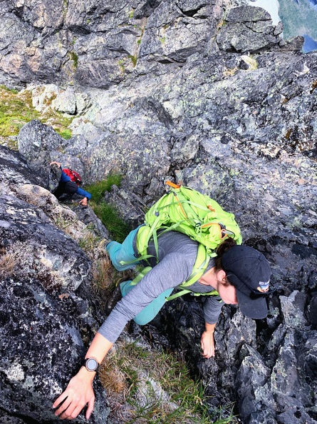
The ridge, like all ridges, offers spectacular views of Tantalus, Sigurd peak & lake, Jimmy Jimmy and Zenith. The wind was picking up and pushing the clouds over from Ossa-Pelion towards the Clowhorn river valley – an encouraging sign for us. While soaking in the view, we continued plodding up along the ridge, scrambling over some rocks, mixed with some faint trails and krummholz patches before eventually reaching the notch between west peak and main summit. We descended into the notch, traversed into a gully and some class 4 moves led us towards the summit plateau.
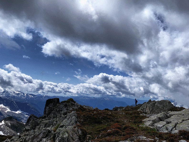
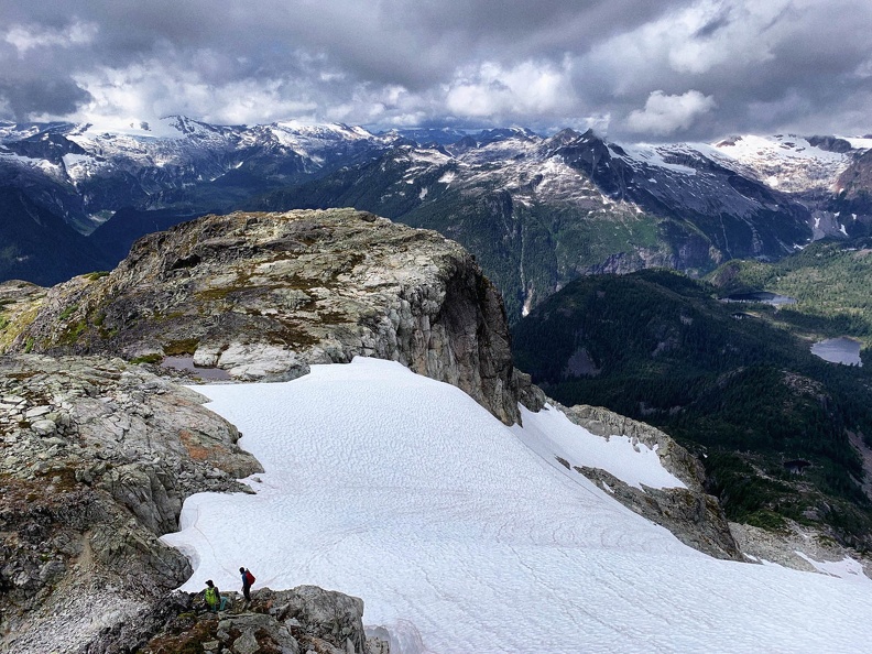
Enroute we missed a trail somewhere, and took one of the multiple gullies – all class 4 – some more exposed than the other though. We reached the summit at 11.00 am – a respectable time of 3 hours and 20 minutes from the moraine camp. Water, snacks and sumptuous views consumed the next 30 minutes in a jiffy before we started our long descent back towards the moraine camp first and then to civilization.
On our way down, we did find the right trail and avoided downclimbing some exposed gullies that we encountered on our way up. It took us 3 hours to reach the moraine camp from the summit. 7 hours total for the moraine camp – summit – moraine camp stretch.
Brittany and Neha broke camps, packed everything and off we went again. The way back was uneventful and we made it back to the car by 7.00 pm.
Overall, it was a pretty big day for me, but never felt rushed. An awesome day in the mountain with an equally awesome company!
Quick stats
- Summit elevation: 7420 feet
- 15 hours car to car with ample breaks along the way.
- 8100+ feet of cumulative elevation gain & loss
- 24 kms out and back (75% of the length is through the forested patch)
- Average slope gradient: 23 degrees (maximum of 60 degress for the class 4 section)